Mediamaps constitue un groupe de recherche, né de la volonté de mettre en synergie les connaissances et le savoir-faire d'équipes issues de trois instituts de la HEIG-VD:

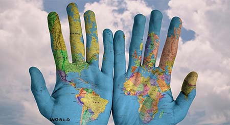
Mediamaps adresse de nombreuses problématiques en lien avec la composante géographique de l'information, pour laquelle les mérites d'une approche interdisciplinaire ne font plus aucun doute.

Les thématiques suivantes se dégagent des projets menés jusqu’à ce jour:

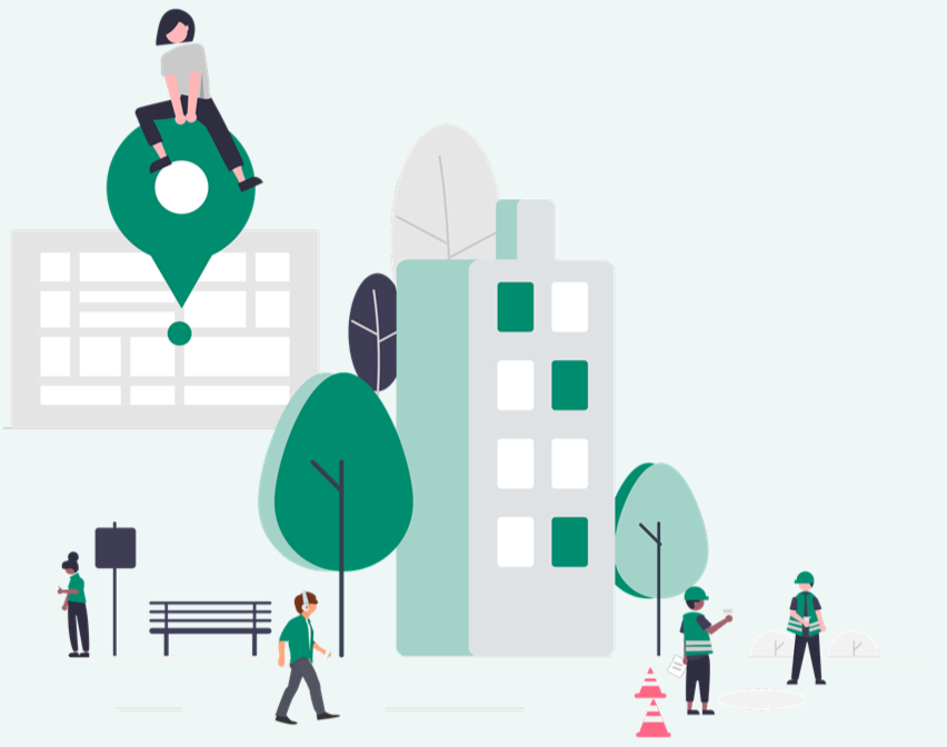
  • Cartographie citoyenne et participative
  • Représentation cartographique et visualisation de données
  • Utilisation et développement des standards d'interopérabilité (de l'OGC, du W3C, mais aussi IIIF et bien d'autres)
  • Développement d’applications géospatiales (desktop, web, mobile)
  • Sciences participatives
  • Réalité augmentée

Projets

image de Activités liées à la standardisation

Activités liées à la standardisation

Depuis la naissance du web, voire de l'internet, l'interopérabilité est au coeur du développement des médias numériques. Il en va de même pour les systèmes d'information géographique. A ce titre, les chercheurs du groupe Mediamaps participent à l'évolution des normes et des standards de la géoinformation, au niveau national comme à l'international.
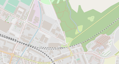
image de Baremaps

Baremaps

Baremaps est un pipeline open source permettant de publier des tuiles vectorielles sur la base d’OpenStreetMap et d’autres sources de données. L’outil redonne au cartographe le contrôle sur le contenu et le style de la carte. Les itérations de développement sont accélérées par prévisualisation en direct des modifications dans le navigateur. Le projet a reçu un soutien financier d’InnoSuisse et fait l’objet de collaborations avec l’industrie.
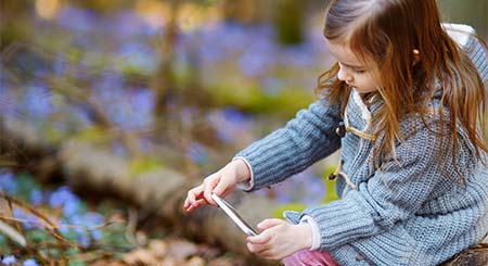
image de Biodiv AR

Biodiv AR

En 2016, un de nos chercheurs faisait le pari de pouvoir détourner le regard de nos jeunes de leurs écrans adorés, grâce à... la technologie. Biosentiers est né, soit une application qui permet de partir à la découverte de la nature. Quatre ans plus tard, les acteurs du projet obtiennent un financement conséquent (Fonds National Suisse, PNR77 - Transformation numérique). Réalité augmentée, processus cognitifs, expérience de terrain... les résultats tomberont en 2023.
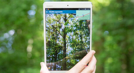
image de  Biosentiers

Biosentiers

Une application de réalité augmentée pour mobiles et tablettes, alliant les technologies des médias numériques à celles de l’information géographique, pour explorer quelques 800 points d’intérêt sur un sentier voué à la découverte de la biodiversité.

image de Crowdplos

Crowdplos

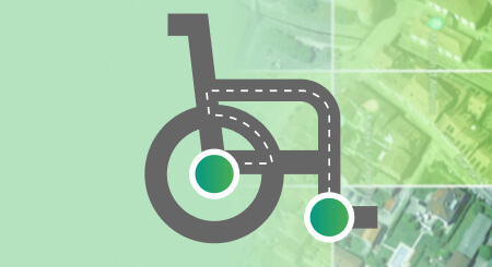
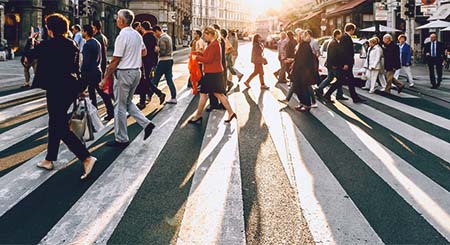
Portée et limites de la la vision par ordinateur pour extraire des caractéristiques, à partir de photographies aériennes, susceptibles de permettre le calcule d’un score d’accessibilité ou niveau de service pour les piétons à mobilité réduite, tels que les personnes handicapées.
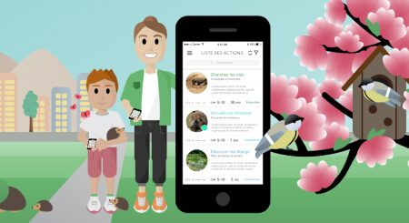
image de Biopocket

Biopocket

Une application ludique et citoyenne de sensibilisation à la biodiversité urbaine. Cette dernière est reconnue par un certain nombre d’acteurs, dont la Confédération, comme un facteur de santé psychologique et physique.
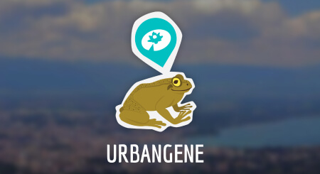
image de Urbangene

Urbangene

Une application de cartographie participative, pour mener une campagne d'analyse sur diverses espèces menacées du Grand Genève, au service de chercheurs de l'EPFL qui mesurent, génétiquement, l'impact de la densification urbaine sur les communautés végétales ou animales lorsqu'elles sont divisées en petites colonies.

image de GeoSQL Journey

GeoSQL Journey

Un concept de gamification dédié à l'apprentissage du SQL spatial issu d'un financement initial de Geographic Information Technology Training Alliance.

image de GeoCity

GeoCity

Geocity est une Infrastructure de déploiement de formulaires à composante géographique développée pour la cyberadministration. Le projet consiste à améliorer les aspects UX/UI afin de favoriser son utilisation au service de démarches participatives.
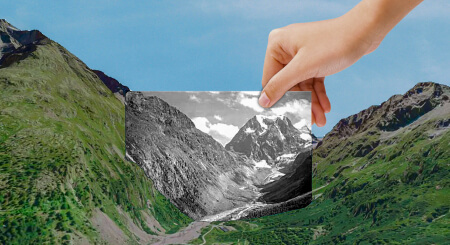
image de Smapshot

Smapshot

La machine à remonter le temps participative. Issue d'un financement initial de la Fondation Hasler, elle permettait de revivre le paysage des années 1960 au travers de cartes postales des Archives de la Construction Moderne projetées dans un globe virtuel. Elle accueille maintenant des dizaines de collections photographiques et s'exporte même en dehors du territoire national.

image de Modos

Modos

Un audit de voirie pour piéton, destiné à la mobilité douce des seniors, qui vise la complémentarité entre des techniques d'apprentissage automatique et des méthodes participatives afin de constituer des collections de données citoyennes utiles à des politiques d'aménagement urbain plus inclusives.

image de ARrange

ARrange

Prototype d'une expérience en réalité augmentée permettant à des clients d'artisans de visualiser leur intérieur avec un sol différent ou un mur repeint. Le projet a étudié notamment la problématique de l’occlusion en réalité augmentée.
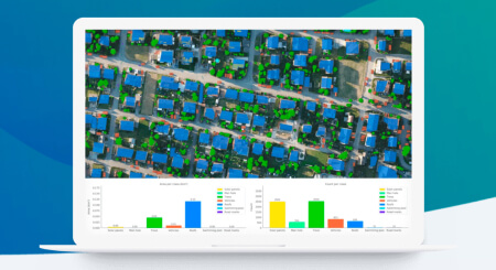
image de Picterra

Picterra

Design d’interface pour la plateforme Picterra qui permet de démocratiser l'observation les changements sur un territoire à l'aide de l’intelligence artificielle et d'images satellites ou aériennes. Elle permet, par exemple, de suivre un parc national, de suivre l'état du revêtement de la route, analyser des champs ou encore réagir plus efficacement face aux catastrophes naturelles.

image de Cœur de ville

Cœur de ville

Une vaste opération participative orchestrée par l'institut d'ingénierie du territoire (insit) et la Ville de Pully en vue de redéfinir le centre urbain (cf. Rapport complet sur le site de Pully). Les médias numériques ont permis la collecte de nombreuses informations via la mise en ligne de questionnaires à composantes géographiques d'un genre inédit.
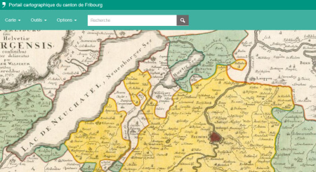
image de FR Usability

FR Usability

Mandat d'expertise dédié à l'évaluation des représentations géographiques, des fonctionnalités, de l'aide en ligne et de l'utilisabilité du nouveau guichet cartographique du canton de Fribourg.

Associations et conférences

Publications

Cannata, M., Giuliani, G., Strigaro D., Ingensand, J., Ertz, O., and Collombin, M. (2023)
OSiRES: Open geospatial standards and reproducible research
Swiss Geoscience Meeting 2023, Mendrisio, Switzerland
Mercier, J., Chabloz, N., Dozot, G., Audrin, C., Ertz, O., Bocher, E., and Rappo, D. (2023)
Impact of geolocation data on augmented reality usability: a comparative user test
The International Archives of the Photogrammetry, Remote Sensing and Spatial Information Sciences, XLVIII-4/W7-2023, 133–140.
Cannata, M., Giuliani, G., Ingensand, J., Ertz, O., and Collombin, M. (2023)
Open geospatial standards and reproducible research
EGU General Assembly 2023, Vienna, Austria
Mercier, J., Chabloz, N., Dozot, G., Ertz, O., Bocher, E., & Rappo, D. (2023)
BiodivAR: A Cartographic Authoring Tool for the Visualization of Geolocated Media in Augmented Reality
ISPRS International Journal of Geo-Information. 2023; 12(2):61
Lotfian, M., Ingensand, J., & Brovelli, M. (2022)
AN APPROACH FOR REAL-TIME VALIDATION OF THE LOCATION OF BIODIVERSITY OBSERVATIONS CONTRIBUTED IN A CITIZEN SCIENCE PROJECT
The International Archives of the Photogrammetry, Remote Sensing and Spatial Information Sciences, XLVIII-4/W1-2022, 271–278.
Ingensand, J., Lecorney, S., Blanc, N., Besse, M., Taylor, J., & Rappo, D. (2022)
AN OPEN API FOR 3D-GEOREFERENCED HISTORICAL PICTURES
The International Archives of the Photogrammetry, Remote Sensing and Spatial Information Sciences, XLVIII-4/W1-2022, 217–222.
Blanc, N., Cannata, M., Collombin, M., Ertz, O., Giuliani, G., & Ingensand, J. (2022)
OGC API STATE OF PLAY – A PRACTICAL TESTBED FOR THE NATIONAL SPATIAL DATA INFRASTRUCTURE IN SWITZERLAND
The International Archives of the Photogrammetry, Remote Sensing and Spatial Information Sciences, XLVIII-4/W1-2022, 59–65.
Ammann, M., Drabble, A., Ingensand, J., & Chapuis, B. (2022)
MAPLIBRE-RS: TOWARD PORTABLE MAP RENDERERS
The International Archives of the Photogrammetry, Remote Sensing and Spatial Information Sciences, XLVIII-4/W1-2022, 35–42.
Chassin, T. and Ingensand, J. (2021)
ARE CITY FEATURES INFLUENCING THE BEHAVIOR OF PHOTOGRAPHERS? AN ANALYSIS OF GEO-REFERENCED PHOTOS SHOOTING ORIENTATION
Int. Arch. Photogramm. Remote Sens. Spatial Inf. Sci., XLIII-B4-2021, 353–359, https://doi.org/10.5194/isprs-archives-XLIII-B4-2021-353-2021, 2021.
Biraghi, C. A., Lotfian, M., Carrion, D., and Brovelli, M. A. (2021)
AI IN SUPPORT TO WATER QUALITY MONITORING
Int. Arch. Photogramm. Remote Sens. Spatial Inf. Sci., XLIII-B4-2021, 167–174, https://doi.org/10.5194/isprs-archives-XLIII-B4-2021-167-2021, 2021.
Lotfian, M. and Ingensand, J. (2021)
USING GEO GEO-TAGGED FLICKR IMAGES TO EXPLORE THE CORRELATION BETWEEN LAND COVER CLASSES AND THE LOCATION OF BIRD OBSERVATIONS
Int. Arch. Photogramm. Remote Sens. Spatial Inf. Sci., XLIII-B4-2021, 189–194, https://doi.org/10.5194/isprs-archives-XLIII-B4-2021-189-2021, 2021.
Chassin, T., Cherqui, A., Ingensand, J., & Joerin, F. (2021)
Impact of Digital and Non-Digital Urban Participatory Approaches on Public Access Conditions: An Evaluation Framework.
ISPRS International Journal of Geo-Information, 10(8).
Ertz, O., Fischer, A., Ghorbel, H., Hüsser, O., Sandoz, R., and Scius-Bertrand, A. (2021)
CITIZEN PARTICIPATION & DIGITAL TOOLS TO IMPROVE PEDESTRIAN MOBILITY IN CITIES
Int. Arch. Photogramm. Remote Sens. Spatial Inf. Sci., XLVI-4/W1-2021, 29–34
Mercier J. & León L., (2021)
edTech, réalité augmentée et exploration
L'école dehors : vers une pédagogie du rapport au monde : dossier thématique. Educateur, 10, 3-18
Lotfian, M., Ingensand, J., & Brovelli, M. (2021)
The Partnership of Citizen Science and Machine Learning: Benefits, Risks, and Future Challenges for Engagement, Data Collection, and Data Quality.
Sustainability, 13(14).
Chassin, T., Ingensand, J., Touya, G., and Christophe, S. (2021)
How do users interact with Virtual Geographic Environments? Users’ behavior evaluation in urban participatory planning
Proc. Int. Cartogr. Assoc., 4, 19, https://doi.org/10.5194/ica-proc-4-19-2021, 2021.
Ertz, O., Fischer, A., Ghorbel, H., Hüsser, O., Sandoz, R., and Scius-Bertrand, A. (2021)
Citizen participation & digital tools to improve pedestrian mobility in cities
Int. Arch. Photogramm. Remote Sens. Spatial Inf. Sci., XLVI-4/W1-2021, 29–34, https://doi.org/10.5194/isprs-archives-XLVI-4-W1-2021-29-2021, 2021.
Ertz, O., Bocher, E., Sorensen, M., Sarafinof, D. (2020)
OGC symbology conceptual model : core part
Open Geospatial Consortium (OGC), 2020-10.
Fürhoff, L. (2020)
Rethinking the usage and experience of clustering in web mapping
In Proceedings of HCI International 2020, 22nd International Conference on Human-Computer Interaction, 19-24 July 2020, Copenhagen, Denmark
Chassin, T., Ingensand, J., Lotfian, M., Ertz, O., & Joerin, F. (2019)
Challenges in creating a 3D participatory platform for urban development
In Proceedings of the ICA; Proceedings of 29th International Cartographic Conference (ICC 2019), 15–20 July 2019, Tokyo, Japan
Lotfian, M., Ingensand, J., Ertz, O., Oulevay, S., & Chassin, T. (2019)
Auto-filtering validation in citizen science biodiversity monitoring
In Proceedings of the ICA; Proceedings of 29th International Cartographic Conference (ICC 2019), 15–20 July 2019, Tokyo, Japan
Blanc, N., Liu, Z., Ertz, O., Rojas, D., Sandoz, R., Sokhn, M., ... & Loubier, J. C. (2019)
Building a crowdsourcing based disabled pedestrian level of service routing application using computer vision and machine learning
In 2019 16th IEEE Annual Consumer Communications & Networking Conference (CCNC) (pp. 1-5). IEEE.
Ingensand, J., Lotfian, M., Ertz, O., Piot, D., Composto, S., Oberson, M., ... & Da Cunha, M. (2018)
Augmented reality technologies for biodiversity education
Proceedings of the 21st Conference on Geo-information science, AGILE 2018, 12-15 June, Lund, Sweden
Sandoz, R., Composto, S., Divorne, S., Ertz, O., & Ingensand, J. (2018)
GeoSQL journey : a gamified learning experience
Proceedings of the Open Source Geospatial Research and Education Symposium (OGRS2018), Lugano. Switzerland, 9-11 October 2018.
Bigler, A., Ertz, O., Rappo, D., Composto, S., & Joerin, F. (2017)
GEOPOLL : integrate cartographic questions in web forms, polls or surveys
Proceedings of Free and Open source Software for Geospatial (FOSS4G) Conference, Boston, 14-19 august 2017
Ingensand, J., Composto, S., Nappez, M.,Produit, T.,Ertz, O., Oberson, M.,Rappo, D., (2016)
Challenges in VGI for scientific projects
PeerJ, 2016, 1992, Open Source Geospatial Research & Education Symposium (OGRS2016), Perugia, Italy
Ingensand, J, Nappez, M, S. Joost, I. Widmer, O.Ertz, D. Rappo (2016)
Keys to successful scientific projects using Volunteered Geographic Information
Workshop: From data on ecosystems to ecosystems of data, EPFL, Lausanne, Switzerland
Ingensand, J. Composto, S., Ertz, O., Rappo, D., Nappez, M., Produit, T., Oberson, M., Widmer, I., Joost, S., (2016)
Keys to successful scientific VGI projects
Open Source Geospatial Research & Education Symposium (OGRS2016), Perugia, Italy
Ingensand, J. Nappez, M. Moullet, C., Gasser, L., Ertz, O., Composto, C. (2016)
Implementation of tiled vector services: a case study
In: Workshop on Spatial Data on the Web 2016 at GIScience 2016. Montreal, Canada
Ingensand, J, Composto, S. Nappez, M., O.Ertz, D. Rappo (2016)
Workshop on Citizen science & VGI
GeoSummit 2016, Expo et congrès de la géoinformation, Bern, Switzerland
Composto, S., Ingensand, J. Nappez, M. Ertz, O. Rappo, D. Bovard, R. Widmer, I. Joost, S. (2016)
How to recruit and motivate users to utilize VGI-systems?
In: Proceedings of the 2016 AGILE conference. Helsinki, Finland
Eisenhut, C. Germann, M., Züricher, R., DiDonato, P., Ertz, O., Ingensand, J., Kottmann, D., Reitz, T.
eCH-0118: Règles de codification GML pour INTERLIS
Association eCH
Rochat, E. Duruz, S. Widmer, I Clémence, A. Desrichard, O. Rappo, D. Ertz, O. Ingensand, J. Theler, J-M. Guessous, I. Joost, S. ( 2015 )
Relationship between land cover type and Body Mass Index ( BMI ) in Geneva
Joint Urban Remote Sensing Event ( JURSE ) 30 March - 1 April 2015, Lausanne, Switzerland
Ingensand, J. Composto, S. Nappez, M., Joost, S. Widmer, I. Ertz, O. Rappo, D.
Motivating citizens to take action for biodiversity conservation using geospatial systems
In: Proceedings of the 2015 AGILE conference. Lisbon, Portugal
Ingensand, J, Nappez, M, S. Joost, I. Widmer, O.Ertz, D. Rappo (2015)
The Urbangene project - experience from a crowdsourced mapping campaign
In: Proceedings of the GISTAM 2014 conference. Barcelona, Spain
Widmer, I. Rochat, E. Leempoel, K. Clémence A., Ertz, O. Rappo, D. Ingensand, J, Theler JM., Guessous,I. Joost, S. (2015)
Biodiversity dynamics and the effect of urban environment on the distribution of genetic variation in the Geneva cross-border area
First Annual Meeting in Conservation Genetics – Science and Practice, Birmensdorf, Switzerland
Joost, S. Baumann, R. Ertz, O. Ingensand J., Widmer I. et al. (2014)
A participatory WebGIS platform to support biodiversity inventory in the Geneva cross-border area
Third Open Source Geospatial Research & Education Symposium (OGRS 2014), Otaniemi, Espoo, Finland, SCIENCE + TECHNOLOGY, 2014