Standardization / National
At national level, MEI researchers contribute to the specialised information management group of eCH, the organisation responsible for establishing Swiss eGovernment standards.
This is achieved by carrying out projects that address issues of concern to the following bodies: Swisstopo, KOGIS, KKGEO, eCH, etc.

eCH-0056
Supporting the revision of the eCH-0056 standard and running workshops with Swiss geoinformation stakeholders.

Standards for augmented reality and geoinformation: state of the art on augmented reality standards, with a view to possible convergence with geoinformation standards.
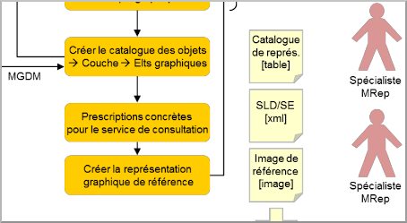
Recommendation on the development of representation models for minimum geodata models (MDGM).

eCH-0118 GML encoding rules for INTERLIS
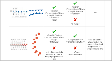
Feasibility study on the use of OGC SLD/SE standards for Swiss geological symbols.
Standardization / International
 At international level, within the Open Geospatial Consortium, these activities mainly concern the interoperability of cartographic representations. These activities enable us to develop expertise that has already helped to address national issues.
For the past 10 years, this work has been carried out in collaboration with our LabSTICC partner, DECIDE team, CNRS - UMR 6285 (Dr. Erwan Bocher, Gwendall Petit) which is responsible for developing the OrbisGISresearch platform.

15.10.2020, a small step for OGC...
SymCore is the result of a long collaboration between various teams at HEIG-VD and CNRS, and is voted to the Open Geospatial Consortium, much to our satisfaction!
Read more:
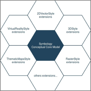
Towards a modular and extensible symbology model for use in the OGC core set of standards for cartographic representation of geospatial data and online mapping services.
- Candidate standard : OGC Symbology Conceptual Model: Core part (18-067r2)
- OGC Testbed-14 (D160) : OGC Testbed-14: Symbology Engineering Report (18-029)
- Article : A redesign of OGC Symbology Encoding standard for sharing cartography. PeerJ Computer Science 4:e143 https://doi.org/10.7717/peerj-cs.143
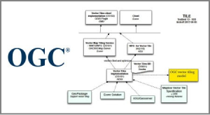
Towards an OGC standardisation of a future vector tile model.
- OGC Vector Tiles Pilot : Tiled Feature Data Conceptual Model Engineering Report (18-076)
- OGC Testbed-13 : Vector Tiles Engineering Report (17-041) / Mandate from the Federal Office of Topography, Swisstopo, concerning the use of vector tiling for the Confederation's geoportal.


