Standardization related activities
Since the birth of the web, or even the Internet, interoperability has been at the heart of the development of digital media. The same goes for geographic information systems. As such, the researchers of the Mediamaps group participate in the development of geoinformation norms and standards, both nationally and internationally.
See projects related to standardization
GeoCity
Geocity is a forms deployment infrastructure with a geographic component developed for e-government. The project involves improving the UX/UI aspects to encourage its use in participative processes.
See the project website
Biodiv AR
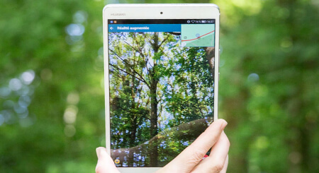
In 2016, one of our researchers bet on being able to divert the gaze of our young people from their beloved screens, thanks to... technology. Biosentiers was born, an application that allows you to discover nature. Four years later, the actors of the project obtain substantial funding (Swiss National Fund, PNR77 - Digital transformation). Augmented reality, cognitive processes, field experience... the results will come in 2023.
Learn more
Baremaps
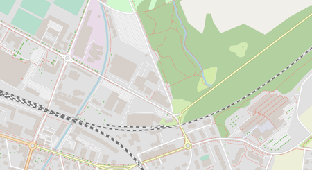
Baremaps is an open source pipeline for publishing vector tiles based on OpenStreetMap and other data sources. The tool gives the cartographer control over the content and style of the map. Development iterations are accelerated by live previewing changes in the browser. The project has received financial support from InnoSuisse and is the subject of collaborations with industry.
Learn more
Smapshot
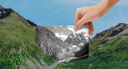
The participatory time machine. Issued with initial funding from the Hasler Foundation, it allowed visitors to relive the landscape of the 1960s through postcards from the Archives of Modern Construction projected onto a virtual globe. It now hosts dozens of photographic collections and is even exported outside the national territory.
See the project site
Modos
A road audit for pedestrians, intended for the soft mobility of seniors, which aims for the complementarity between automatic learning techniques and participatory methods in order to constitute collections of citizen data useful for more inclusive urban development policies.
Learn more
Biosentiers
An augmented reality application for mobiles and tablets, combining digital media technologies with those of geographic information, to explore some 800 points of interest on a path dedicated to the discovery of biodiversity.
See the project site
ARrange
Prototype of an augmented reality experience allowing craftsmen's customers to visualize their interior with a different floor or a repainted wall. The project studied in particular the issue of occlusion in augmented reality.
Learn more
Crowdplos
Scope and limitations of computer vision to extract features from aerial photographs that may allow the calculation of an accessibility score or level of service for pedestrians with reduced mobility, such as the disabled.
En savoir plus
Picterra
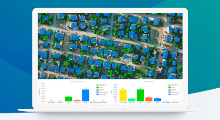
Interface design for the Picterra platform, which makes it possible to democratize the observation of changes on a territory using artificial intelligence and satellite or aerial images. It allows, for example, to monitor a national park, to follow the state of the road surface, to analyze fields or to react more efficiently to natural disasters.
See the Picterra website
Biopocket
A fun and citizen application to raise awareness of urban biodiversity. The latter is recognized by a certain number of actors, including the Confederation, as a factor of psychological and physical health.
See the project site
Cœur de ville
A vast participatory operation orchestrated by the regional engineering institute (insit) and the City of Pully with a view to redefining the urban center (cf. Full report on the Pully website). Digital media have made it possible to collect a great deal of information via the online publication of questionnaires with geographical components of a new kind.
Learn more
Urbangene
A participatory mapping application, to conduct an analysis campaign on various threatened species in Greater Geneva, at the service of EPFL researchers who measure, genetically, the impact of urban densification on plant or animal communities when they are divided into small colonies.
See the project site
FR Usability
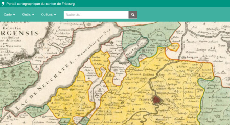
Mandate of expertise dedicated to the evaluation of the geographical representations, the functionalities, the online help and the usability of the new cartographic window of the canton of Fribourg.
Geoportal of the canton of Fribourg
GeoSQL Journey
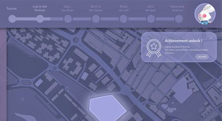
A gamification concept dedicated to learning spatial SQL stemming from initial funding from the Geographic Information Technology Training Alliance.
Learn more
Associations and conferences
Members of the Mediamaps research group actively participate in the various events, associations and conferences listed below:

Geo Summit
Organisation of workshops (on the theme of VGI in 2016), member of the committee for 2018

Comitato Scientifico Italo-Svizzero per La Geoinformazione
Organisation of meetings between laboratories (EPFL, ETHZ, Politecnico di Milano, HEIG-VD, SUPSI)

Open Source Geospatial Research Symposium
Organisation and participation (organising committee; organisation of sessions; review, etc)

Open Geospatial Consortium
Through the group's activities activities, the HEIG-VD is represented in the group and active as an Associate Member
Cannata, M., Giuliani, G., Strigaro D., Ingensand, J., Ertz, O., and Collombin, M. (2023)
OSiRES: Open geospatial standards and reproducible research
Swiss Geoscience Meeting 2023, Mendrisio, Switzerland
Mercier, J., Chabloz, N., Dozot, G., Audrin, C., Ertz, O., Bocher, E., and Rappo, D. (2023)
Impact of geolocation data on augmented reality usability: a comparative user test
The International Archives of the Photogrammetry, Remote Sensing and Spatial Information Sciences, XLVIII-4/W7-2023, 133–140.
Cannata, M., Giuliani, G., Ingensand, J., Ertz, O., and Collombin, M. (2023)Open geospatial standards and reproducible research
EGU General Assembly 2023, Vienna, Austria
Mercier, J., Chabloz, N., Dozot, G., Ertz, O., Bocher, E., & Rappo, D. (2023)
BiodivAR: A Cartographic Authoring Tool for the Visualization of Geolocated Media in Augmented Reality
ISPRS International Journal of Geo-Information. 2023; 12(2):61
Ingensand, J., Lecorney, S., Blanc, N., Besse, M., Taylor, J., & Rappo, D. (2022)AN OPEN API FOR 3D-GEOREFERENCED HISTORICAL PICTURES
The International Archives of the Photogrammetry, Remote Sensing and Spatial Information Sciences, XLVIII-4/W1-2022, 217–222.
Blanc, N., Cannata, M., Collombin, M., Ertz, O., Giuliani, G., & Ingensand, J. (2022)OGC API STATE OF PLAY – A PRACTICAL TESTBED FOR THE NATIONAL SPATIAL DATA INFRASTRUCTURE IN SWITZERLAND
The International Archives of the Photogrammetry, Remote Sensing and Spatial Information Sciences, XLVIII-4/W1-2022, 59–65.
Ammann, M., Drabble, A., Ingensand, J., & Chapuis, B. (2022)MAPLIBRE-RS: TOWARD PORTABLE MAP RENDERERS
The International Archives of the Photogrammetry, Remote Sensing and Spatial Information Sciences, XLVIII-4/W1-2022, 35–42.
Biraghi, C. A., Lotfian, M., Carrion, D., and Brovelli, M. A. (2021)AI IN SUPPORT TO WATER QUALITY MONITORING
Int. Arch. Photogramm. Remote Sens. Spatial Inf. Sci., XLIII-B4-2021, 167–174, https://doi.org/10.5194/isprs-archives-XLIII-B4-2021-167-2021, 2021.
Ertz, O., Fischer, A., Ghorbel, H., Hüsser, O., Sandoz, R., and Scius-Bertrand, A. (2021)CITIZEN PARTICIPATION & DIGITAL TOOLS TO IMPROVE PEDESTRIAN MOBILITY IN CITIES
Int. Arch. Photogramm. Remote Sens. Spatial Inf. Sci., XLVI-4/W1-2021, 29–34
Lotfian, M., Ingensand, J., & Brovelli, M. (2021)The Partnership of Citizen Science and Machine Learning: Benefits, Risks, and Future Challenges for Engagement, Data Collection, and Data Quality.
Sustainability, 13(14).
Chassin, T., Ingensand, J., Touya, G., and Christophe, S. (2021)How do users interact with Virtual Geographic Environments? Users’ behavior evaluation in urban participatory planning
Proc. Int. Cartogr. Assoc., 4, 19, https://doi.org/10.5194/ica-proc-4-19-2021, 2021.
Ertz, O., Fischer, A., Ghorbel, H., Hüsser, O., Sandoz, R., and Scius-Bertrand, A. (2021)Citizen participation & digital tools to improve pedestrian mobility in cities
Int. Arch. Photogramm. Remote Sens. Spatial Inf. Sci., XLVI-4/W1-2021, 29–34, https://doi.org/10.5194/isprs-archives-XLVI-4-W1-2021-29-2021, 2021.
Chassin, T., Ingensand, J., Lotfian, M., Ertz, O., & Joerin, F. (2019)Challenges in creating a 3D participatory platform for urban development
In Proceedings of the ICA; Proceedings of 29th International Cartographic Conference (ICC 2019), 15–20 July 2019, Tokyo, Japan
Lotfian, M., Ingensand, J., Ertz, O., Oulevay, S., & Chassin, T. (2019)Auto-filtering validation in citizen science biodiversity monitoring
In Proceedings of the ICA; Proceedings of 29th International Cartographic Conference (ICC 2019), 15–20 July 2019, Tokyo, Japan
Blanc, N., Liu, Z., Ertz, O., Rojas, D., Sandoz, R., Sokhn, M., ... & Loubier, J. C. (2019)Building a crowdsourcing based disabled pedestrian level of service routing application using computer vision and machine learning
In 2019 16th IEEE Annual Consumer Communications & Networking Conference (CCNC) (pp. 1-5). IEEE.
Ingensand, J., Lotfian, M., Ertz, O., Piot, D., Composto, S., Oberson, M., ... & Da Cunha, M. (2018)Augmented reality technologies for biodiversity education
Proceedings of the 21st Conference on Geo-information science, AGILE 2018, 12-15 June, Lund, Sweden
Sandoz, R., Composto, S., Divorne, S., Ertz, O., & Ingensand, J. (2018)GeoSQL journey : a gamified learning experience
Proceedings of the Open Source Geospatial Research and Education Symposium (OGRS2018), Lugano. Switzerland, 9-11 October 2018.
Bigler, A., Ertz, O., Rappo, D., Composto, S., & Joerin, F. (2017)GEOPOLL : integrate cartographic questions in web forms, polls or surveys
Proceedings of Free and Open source Software for Geospatial (FOSS4G) Conference, Boston, 14-19 august 2017
Ingensand, J., Composto, S., Nappez, M.,Produit, T.,Ertz, O., Oberson, M.,Rappo, D., (2016)
Challenges in VGI for scientific projects
PeerJ, 2016, 1992, Open Source Geospatial Research & Education Symposium (OGRS2016),
Perugia, Italy
Ingensand, J, Nappez, M, S. Joost, I. Widmer, O.Ertz, D. Rappo (2016)
Keys to successful scientific projects using Volunteered Geographic Information
Workshop: From data on ecosystems to ecosystems of data, EPFL, Lausanne, Switzerland
Ingensand, J. Composto, S., Ertz, O., Rappo, D., Nappez, M., Produit, T., Oberson, M., Widmer, I., Joost, S., (2016)
Keys to successful scientific VGI projects
Open Source Geospatial Research & Education Symposium (OGRS2016),
Perugia, Italy
Ingensand, J. Nappez, M. Moullet, C., Gasser, L., Ertz, O., Composto, C. (2016)
Implementation of tiled vector services: a case study
In: Workshop on Spatial Data on the Web 2016 at GIScience 2016.
Montreal, Canada
Ingensand, J, Composto, S. Nappez, M., O.Ertz, D. Rappo (2016)
Workshop on Citizen science & VGI
GeoSummit 2016, Expo et congrès de la géoinformation, Bern, Switzerland
Composto, S., Ingensand, J. Nappez, M. Ertz, O. Rappo, D. Bovard, R. Widmer, I. Joost, S.
(2016)
How to recruit and motivate users to utilize VGI-systems?
In: Proceedings of the 2016 AGILE conference.
Helsinki, Finland
Eisenhut, C. Germann, M., Züricher, R., DiDonato, P., Ertz, O., Ingensand, J., Kottmann, D.,
Reitz, T.
eCH-0118: Règles de codification GML pour INTERLIS
Association eCH
Rochat, E. Duruz, S. Widmer, I Clémence, A. Desrichard, O. Rappo, D. Ertz, O. Ingensand,
J. Theler, J-M. Guessous, I. Joost, S. ( 2015 )
Relationship between land cover type and Body Mass Index ( BMI ) in Geneva
Joint Urban Remote Sensing Event ( JURSE ) 30 March - 1 April 2015,
Lausanne, Switzerland
Ingensand, J. Composto, S. Nappez, M., Joost, S. Widmer, I. Ertz, O. Rappo, D.
Motivating citizens to take action for biodiversity conservation using geospatial systems
In: Proceedings of the 2015 AGILE conference. Lisbon, Portugal
Ingensand, J, Nappez, M, S. Joost, I. Widmer, O.Ertz, D. Rappo (2015)
The Urbangene project - experience from a crowdsourced mapping campaign
In: Proceedings of the GISTAM 2014 conference. Barcelona, Spain
Widmer, I. Rochat, E. Leempoel, K. Clémence A., Ertz, O. Rappo, D. Ingensand, J, Theler
JM., Guessous,I. Joost, S. (2015)
Biodiversity dynamics and the effect of urban environment on the distribution of genetic
variation in the Geneva cross-border area
First Annual Meeting in Conservation Genetics – Science and Practice, Birmensdorf, Switzerland
Joost, S. Baumann, R. Ertz, O. Ingensand J., Widmer I. et al. (2014)
A participatory WebGIS platform to support biodiversity inventory in the Geneva
cross-border area
Third Open Source Geospatial Research & Education Symposium (OGRS 2014),
Otaniemi, Espoo, Finland, SCIENCE + TECHNOLOGY, 2014

